Surveying in Japan

‘Measuring the countryside’ (Chihô sokuryô no zu 地方測量之図), woodcut, color, c. 1848 (Kaei 1), National Diet Library Tokyo, URL: http://dl.ndl.go.jp/info:ndljp/pid/1307113

An overview of the history of surveying completes this tutorial in place of a conclusion. In the largely agrarian economy, preceding industrialization, land surveys were an instrument to define boundaries for the assertion of land claims and to negotiate the value of fields for the purpose of taxation. The ruling elite accordingly initiated survey projects since Japanese antiquity. Evidence are the maps of newly reclaimed fields, estates and villages, which are handed down to us from the eighth to the sixteenth centuries.

Between 1582 and 1598, Toyotomi Hideyoshi (1537–1598) initiated a comprehensive land survey, the so-called ‘survey of the retired regent’ (Taikō kenchi 太閤検地). The survey differed from previous cadastral surveys, attempted in the sixteenth century. First, the survey was not based on the declaration of local inhabitants (sashidashi kenchi 差出検地), but involved actual measurement. Second, it introduced unified units for the measurement and categorization of land. The survey thus allowed to establish the village as the basic tax unit and to levy ‘taxes in standardized rice measures’ (kokudaka 石高). Finally, it clarified rights to landownership, which implied a reinforcement of ties of peasants to the land. Following Hideyoshi's model, the Tokugawa bakufu ordered the submission of provincial maps (kuniezu) from daimyo throughout Japan at five occasions, in 1605, 1633, 1644, 1697 and 1835.

Andō Hiroshi 安藤博, Tokugawa bakufu kenji yōryaku 徳川幕府県治要略 (Toyko: Akagi Shoten, 1915), pp. 174–175; 210–211, held by the National Diet Library Tokyo, URL: http://dl.ndl.go.jp/info:ndljp/pid/980845/123

Before the development of aerial photography and satellite imagery, survey methods implied to walk the land. Like in Europe, one method was to view the land and inquire local inhabitants. Though this method did not allow accurate mapping, it allowed the assertion of spatial knowledge: streams, mountains and forests, which entered maps, were topographical distinctions. The estimation of land without measurement (ikenchi 居検地) was conducted until the Edo period, though then on previously measured land only and usually upon the request of villagers.

Though the Tokugawa bakufu kenji yōryaku was published after the fall of the bakufu, it is sought to be a valuable source about the duties of officials on land, directly administered by the bakufu. Its illustrations give us insight into survey methods, involving measurement. One method was to divide areas with ropes (mizunawa 水縄). Axes (jūji 十字) and set squares (kyokushaku 曲尺) guaranteed that the ropes were crossed in right angles, whereas measuring rods (kenzao 間竿, 尺杖 shukuzue) served to check the accuracy of the interval marks on the ropes. Ranging poles in the corners (saimidake 細見竹) or in the intervals (bontendake 梵天竹) circumscribed the area to be measured. Another method, applied in case of uneven terrain, was a circumferential survey (mawari kenchi 回検地), whereas intervals within the area were left unmeasured, but computated from the measured circumference. The illustrations in the Tokugawa bakufu kenji yōryaku not only offer a glimpse into survey methods but also the ‘rituals’, which marked the presence of the lord's authority in local society.

‘Compass and pole,’ and ‘theodolite,’ in Akita Jūshichirō 秋田十七郎 (also Tsuda Gigi 津田宜義, ?–?) Sanpō jikata taisei 算法地方大成 ([Edo] Nihonbashidōri, 1837), vol. 5, National Diet Library Tokyo, URL: http://dl.ndl.go.jp/info:ndljp/pid/2608689

The comprehensive land surveys in the late sixteenth and early seventeenth centuries occurred, when new surveying techniques were introduced to Japan by Jesuit missionaries. Whereas a compass, mounted on a pole (shōhōgi 小方儀) to indicate declination, was integrated into traditional cartography, which placed an emphasis on cardinal points, the theodolite (chūhōgi 中方儀, daihōgi 方儀) allowed to apply trigonometry, that is, the measurement of angles rather than distances, in surveys. This development of ‘mathematics as a practical science in the Edo period’ (see the National Diet Library Tokyo) allowed to measure longer distances in a faster pace of time. The theodolite also allowed to measure the height above sea level. This was an important step to determine a respective position with reference to celestial bodies.

Designations of astronomical instruments also refer to a Portuguese influence, such as the quadrant (watarante, kuhadarantei) or the astrolabe (isutarabiyo, asutarabiyo). However, the Japanese turned to astronomical observation to locate geographical coordinates in particular in the late seventeenth and early eighteenth centuries, that is, after the ban of the Iberians and the import of European cartography and geodesy via the Dutch. Evidence of this trend are Hosoi Kotaku's (1658–1735) ‘Complete book of the secret art of surveying and mapping’ (Hiden chiiki zuho daizensho) of 1717, Matsumiya Toshitsugu's (1686–1780) ‘Techniques of protraction’ (Bundo yojutsu) of 1728, Murai Masahiro’s (1693–1759) ‘Guide to surveying’ (Ryōchi shinan) of 1734, and Akita Jūshichirō's (alias Tsuda Gigi, ?–?) ‘Accomplishment to computate coasts’ (Sanpō jikata taisei) of 1837. 

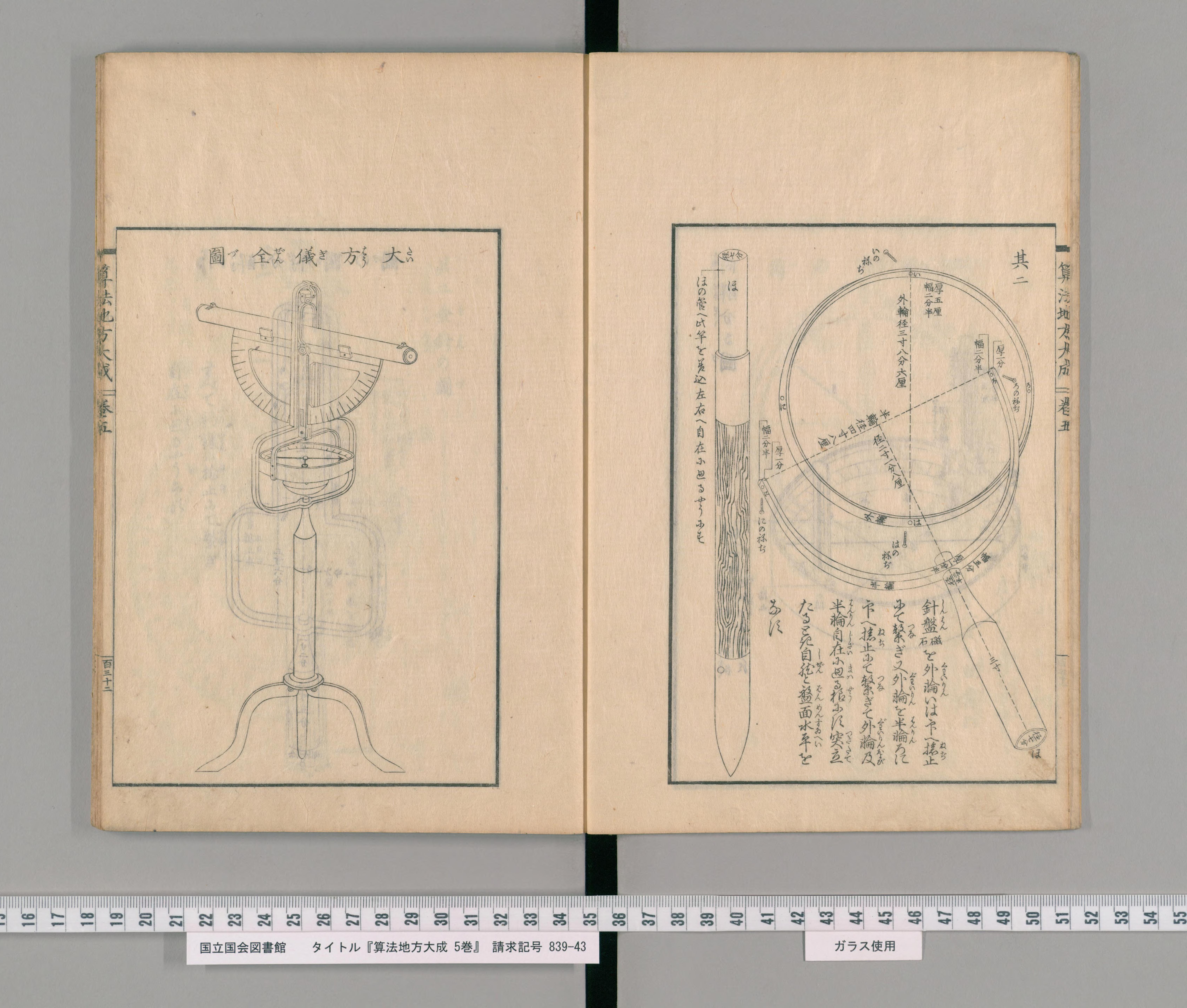
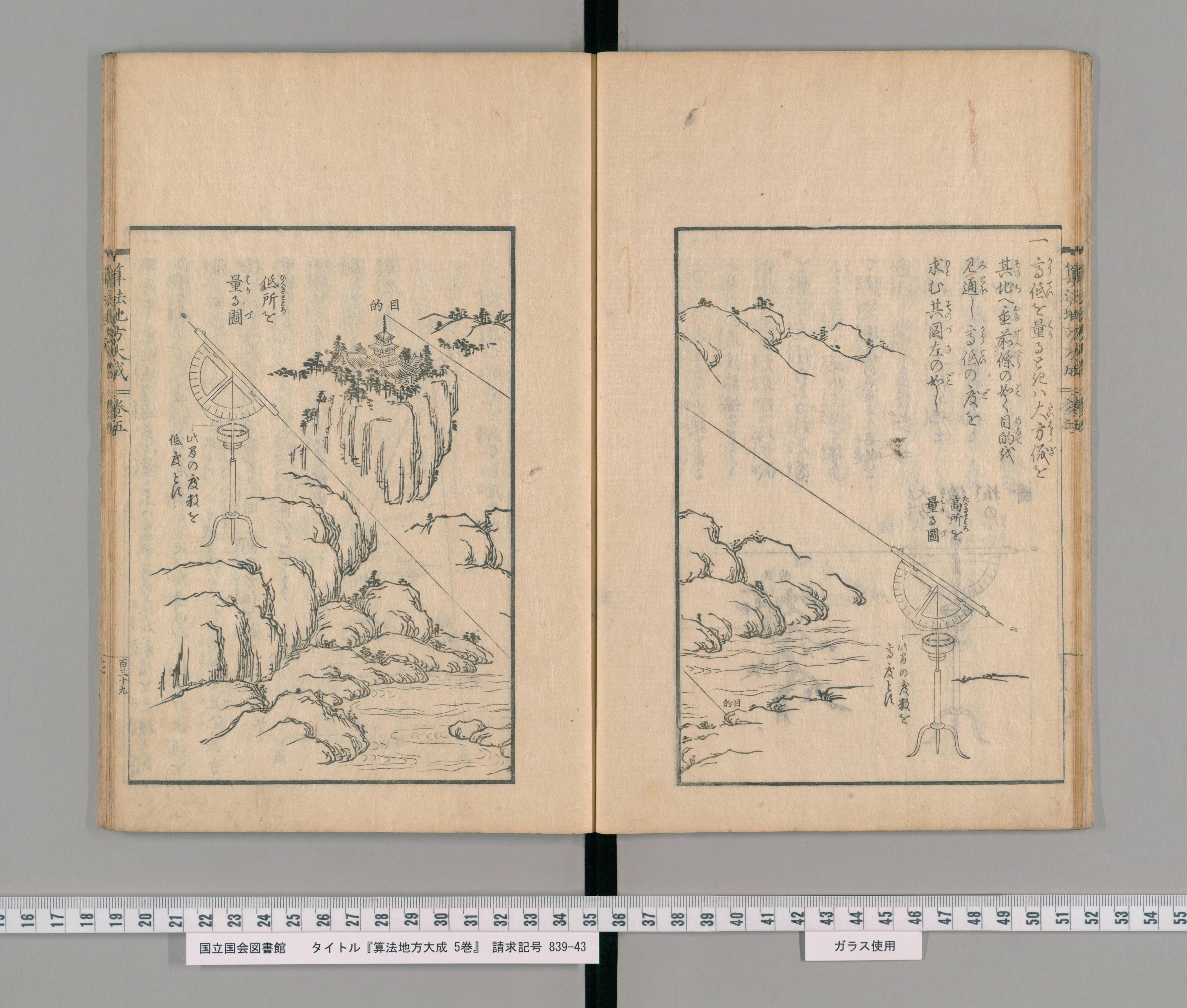
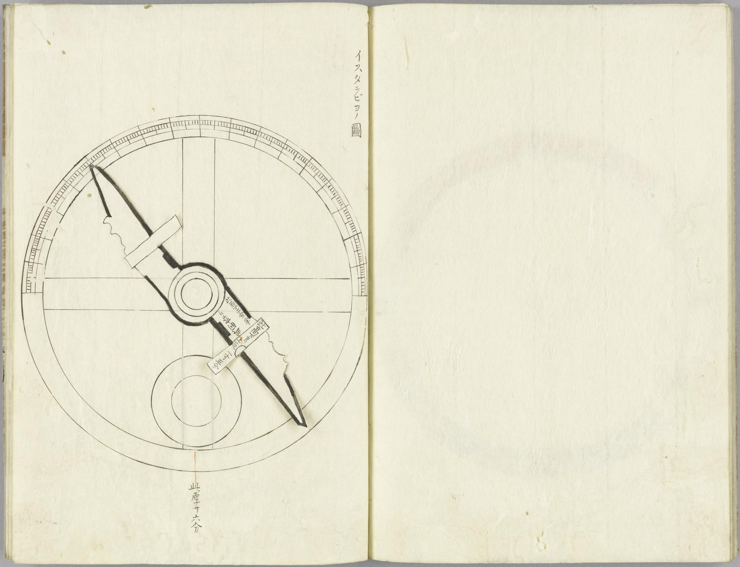
‘Astolabe,’ in Hosoi Kotaku 細井広沢, Hiden chiiki zuho daizensho 秘伝地域図法大全書, [s.n.: s.d.], vol. 3, National Diet Library Tokyo, URL: http://dl.ndl.go.jp/info:ndljp/pid/3508801/36 ;

cf. Unno Kazutaka, “Cartography in Japan,” in Harvey, B. and D. Woodward, eds., History of Cartography (Chicago: University of Chicago Press, 1994), p. 393; Frumer, Yulia, Making Time: Astronomical Time Measurement in Tokugawa Japan (Chicago: University of Chicago Press, 2018), p. 98.

The Jesuit Alessandro Valignano (1539–1606) writes:

From olden times the Japanese have had geographical maps of all these islands, but as they had no knowledge of cosmography and knew nothing about degrees and the elevation of the pole, they had no reliable and good drawings. They also did not know accurately the position and latitude of the islands.

cit. in Schütte, Jos. Fr., ‘Ignacio Moreira of Lisbon, Cartographer in Japan 1590–1592,’ Imago Mundi 16 (1962), pp. 116–128, here: p. 123.

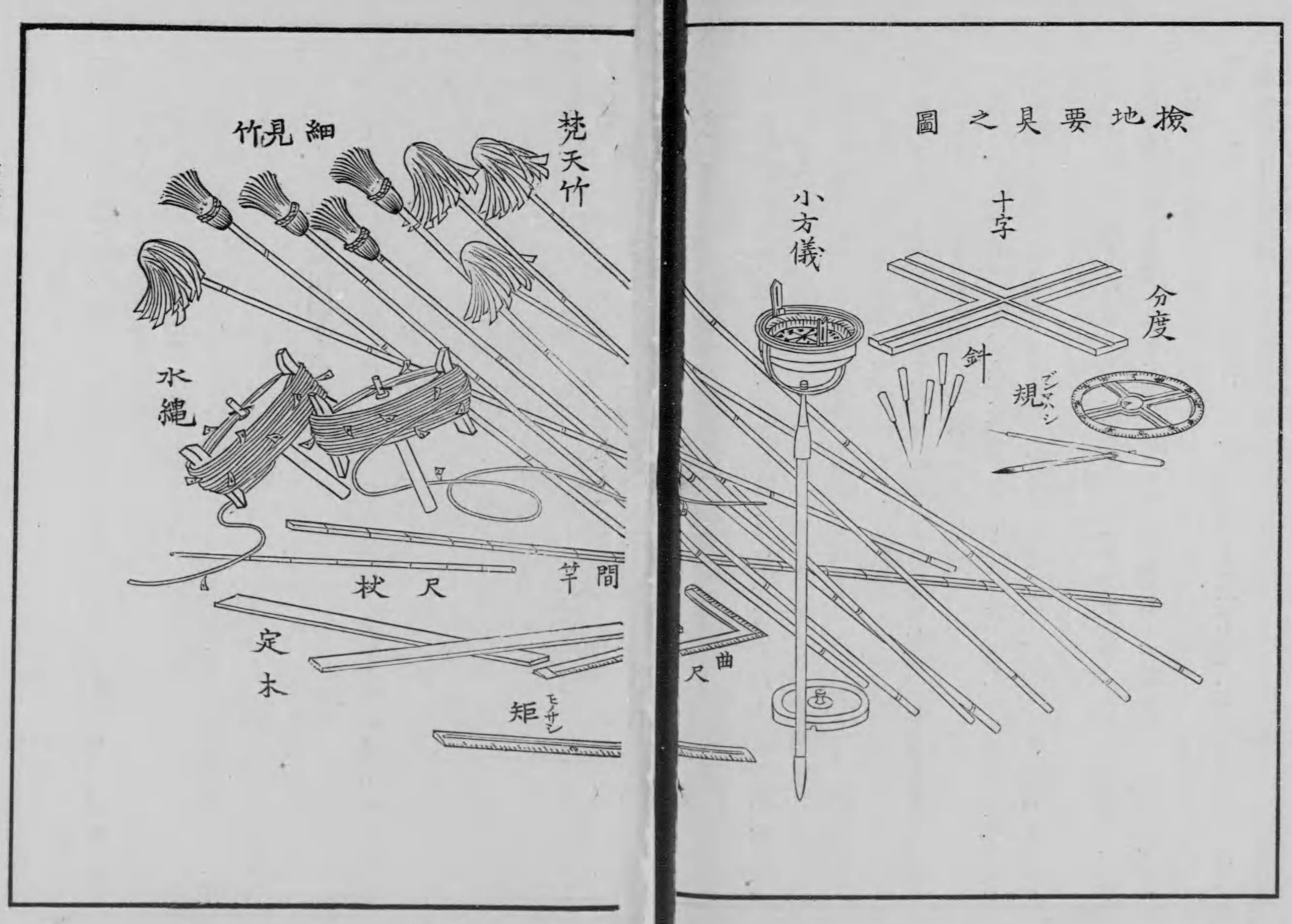
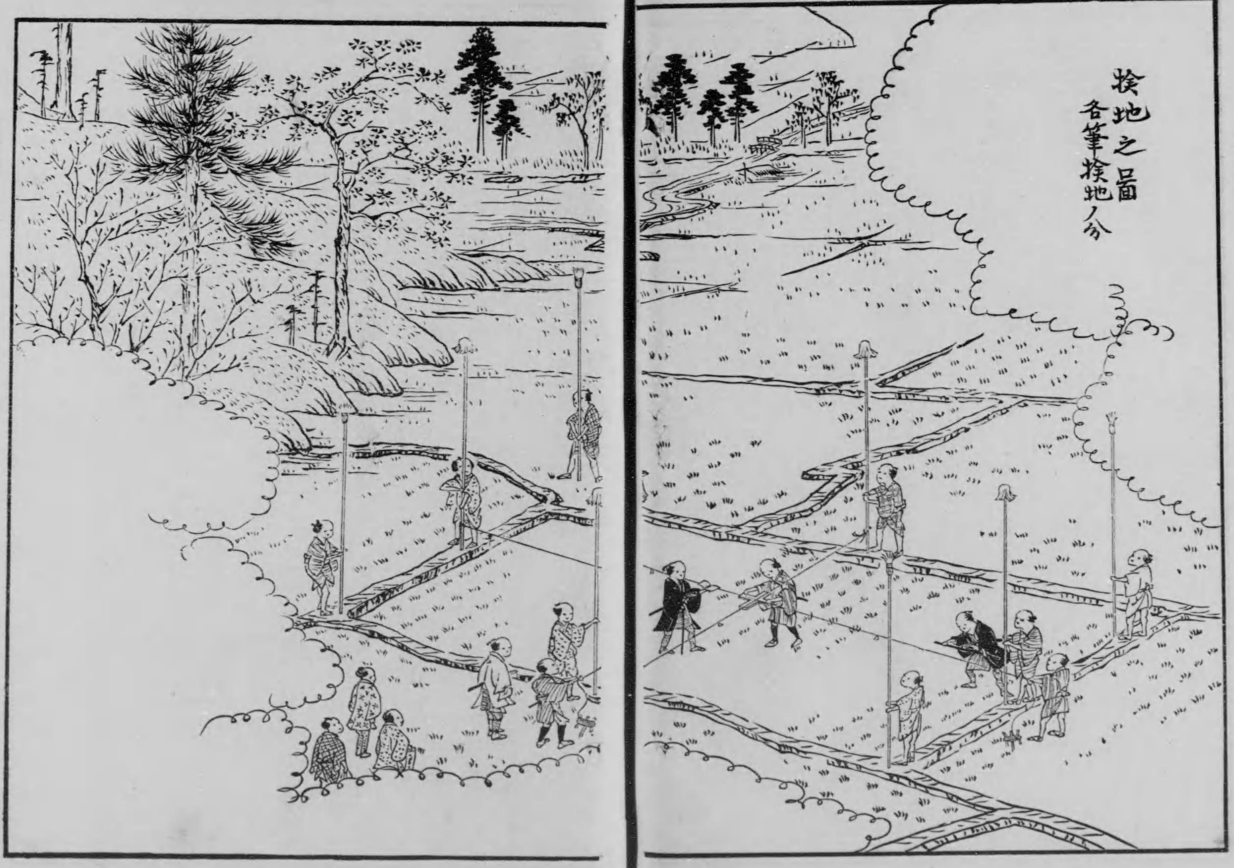
In the Hiden chiiki zuho daizensho of 1717, Hosoi Kotaku also refers to the importance of astonomical observation for accurate mapping. He introduced the neologism ‘surveying’ (測量 sokuryō), by shortening the Chinese ‘observe the sky and estimate the earth’ (sokuten ryōchi 測天量地). He argued that the greater part of measurement methods had been introduced from China more than thousand years ago, but that to determine the position of a place the integration of ‘Dutch’ astronomical measurement was also necessary.

Just several decades earlier, Yasui Santetsu, the younger (alias Shibukawa Shunkai, 1639–1715), had made a map, in which he estimated the latitudes and longitudes of western Japan, and in 1678 he had localized Mafu in Edo to 35°38' (implying only 1'17" diference to Meiji-period surveys). Shibukawa is also known for having built the first terrestrial globe in Japan. In 1719, the eighth Tokugawa shogun Yoshimune (1684–1751), a promoter of calendrical and astronomical computation and the founder of the observatory in Edo's Kanda quarter, ordered Takebe Katahiro (1664–1739) to make a revised map of Japan. Katahiro based his map, completed in 1723 and revised until 1728, on the fourth shogunal survey project of provinces, initiated in 1697. But he also used a lodestone to determine directions and unified the scale in the map.

In 1800, Inō Tadataka (1745–1818) began surveying the whole coast of Japan. His students completed his project in 1821. Tadataka relied on established survey methods of triangulation and distance measurements during day time. But he also based his survey on astronomical observation at night time, by using a sextant, a meridian device and a pendulum clock, the latter allowing him to time celestial phenomena. A section ‘Middle-of-Night Obervation’ (Yonaka sokuryō no zu 夜中測量之図)’ of a picture scroll, with the title ‘Pictures of Urashima Survey’ (Urashima sokuryō no zu 浦島測量之図), of 1806, held by Irifuneyama Memorial Museum (Kure City, Hiroshima Prefecture) shows Tadataka and his survey team at workThe survey allowed in particular to accurately map Ezo (present-day Hokkaido). The so-called  ‘complete map of Japan's coast lines’ (Dai Nihon enkai yochi zenzu 大日本沿海輿地全図) or ‘Inō maps’ (Inō-zu 伊能図) (online via the Library of Congress) were used and copied until the Meiji period. 

Nagakubo Sekisui 長久保赤水, ‘World map’ (literally, ‘general map of the world, mountains and seas’, J., Sankai yochi zenzu 山海輿地全圖) (Naniwa [Osaka]: Asanoyahee, s.d.), woodcut, colors, 114 x 160cm, Kyoto University Library, URL: https://rmda.kulib.kyoto-u.ac.jp/item/rb00022877

The layout of maps refers to the increasing integration of European cartography and geodesy in Japan. Several Portuguese-style nautical charts, used by Japanese licensed merchant ships in the late sixteenth and early seventeenth centuries, mark degrees of longitude and latitude and convert these into Japanese measurements. Ricci-type world maps circulated in print in Japan from the early seventeenth century show the world in a spherical shape and mark latitudes and longitudes. 

Nagakubo Sekisui's (1717–1801) ‘Revised complete map of Japan and earth distances’ (Kaisei Nihon yochi rotei zenzu 改正日本輿地路程全図) of 1779 was the first Japanese map in print, placing Japan on a grid according to a fixed scale – though neither based on an actual survey nor using longitudes in a strict sense (online via the Library of Congress). Sekisui also made a world map, the so-called ‘general map of the world, mountains and seas’ (Sankai yochi zenzu) (seen to the left, also online via the Library of Congress). Though it largely relies on Ricci-type maps, it not only includes new islands but also, like Sekisui's Japan map, indicates mountain chains through hachures and shades, referring to the measurement of altitutes.

In 1792, Shiba Kōkan (1747–1818) published a first copper-plate map that showed the world in two hemispheres, the so-called Yochi zenzu (reprinted as the Chikyū zenzu 地球全図 around 1795, online via the Library of Congress). It reveals Dutch influence, not only by being more accurate than Ricci-type world maps, but also by referring to astronomical observation: the left plate shows different perspectives of the terrestrial globe in the four corners, and the right plate shows the position of the earth in relation to the moon and the sun in different constellations. In 1810, the astronomer Takahashi Kageyasu (1785–1829), known for having supervised the completion of Inō's maps of Japan's coastlines and for having handed over maps of the Northern territories to Siebold without permission, produced a ‘revised map of the world’ (Shintei bankoku zenzu 新訂万国全図) (held by the National Diet Library Tokyo). As a special feature, the hemisphere, showing the Eurasian landmass and Austrialia is called ‘Western hemisphere’ and the one, showing America, ‘Eastern hemisphere’. Compared to Kōkan's map, Kageyasu's map reflects then new knowledge about the northern territories, by showing Sakhalin as an island and not connected to the continent.

.

‘New map of famous places in Kyoto and surroundings’ (Kyōto shi gun meisho shinzu 京都市郡名所新圖), woodcut, color, 1890 (Meiji 23), University of Zurich, Japan Library.

The history of survey projects, methods and instruments and of the resulting maps are a field of the history of knowledge, by referring to so-to-say Latourian ‘centers of calculation’ that show the linkage between technological progress and shifting power relations. However, they also offer a glimps into economic, social and cultural formations: we recognize the importance of walking the land in largely agrarian pre-modern and early modern societies, the occasions, when spatial and status divisions were overcome, and the travel routes, which captured the imagination of people. The history of surveying and maps also gives insight into the sense of space in past societies: a shrine in a map may refer to the boundary between familiar space of fields and settlements and unoccupied space of mountains; blank or conventionalized areas show the extent of unknown lands; a foreign ship in a map indicates the notion of the outside world; and a distance measurement or a station gives insight into the travel pace and routine in early modern Japan.

After the Meiji Restoration of 1868, international developments and industrialization led to the making of new map types in Japan. Modern maps, however, not only reflect the demands of scientific accuracy and the concerns about urban aggregation, resource access or ecology, but sometimes appear to be ‘palimpsests’, by integrating past visions of space. This is suggested by the ‘New map of famous places in Kyoto and surroundings’ (Kyōto shi gun meisho shinzu), published in 1890. The map creates the illusion of a timeless spatial stability as well as - or rather, precisely because of this illusion - reminds us of historical change.