Searching for old Japanese maps

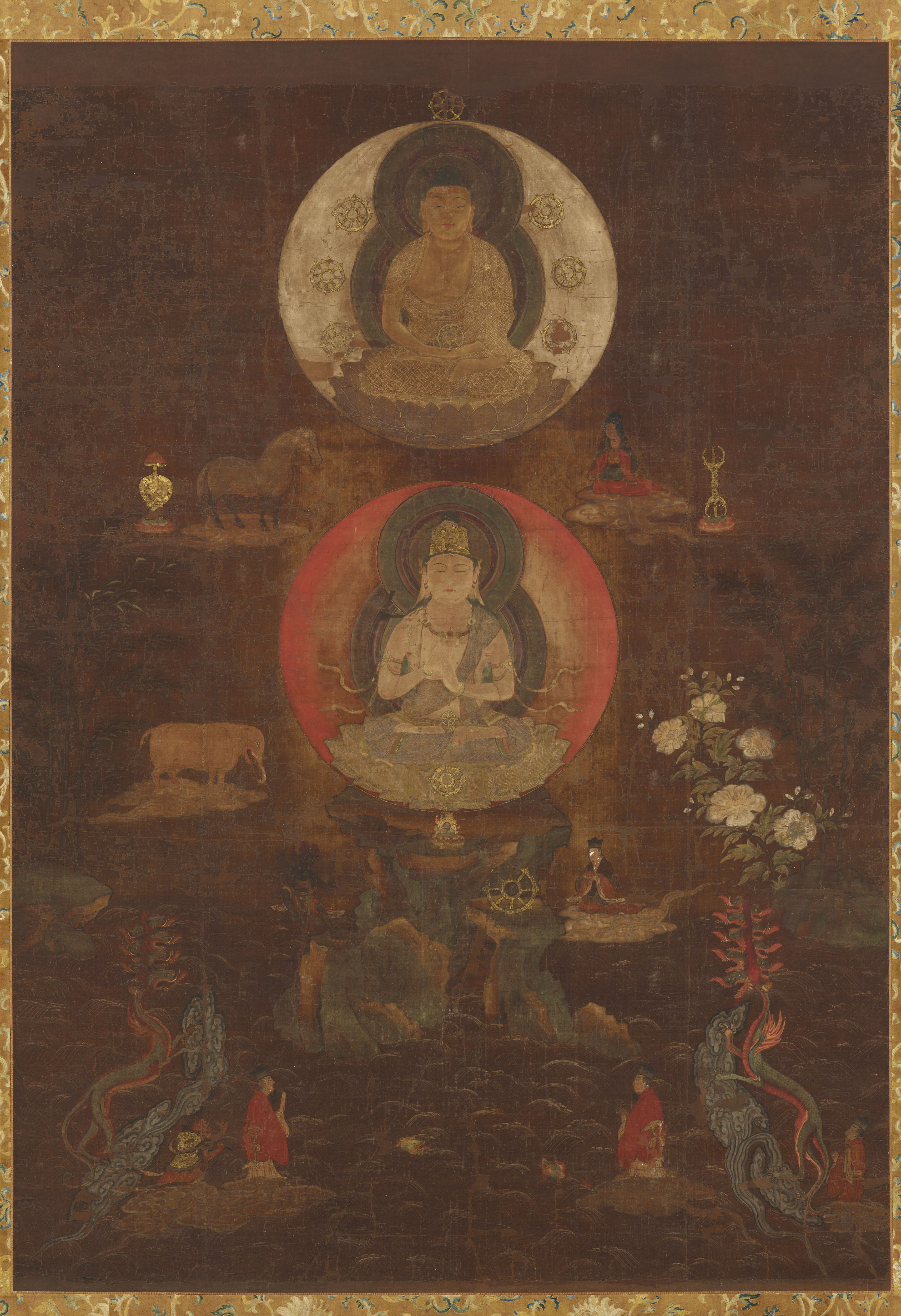
‘Mandala of the Great Cranial Protuberance’ (Daibutchō mandara 大仏頂曼荼羅), hanging scroll, ink and colors on silk, gold-leaf, decorated with thin metal strips, 125.5 x 88.5 cm, Heian period, 12th century, Important Cultural Property. Attribution & Image creation: Nara National Museum/photo by: Sasaki Kyōsuke; URL: https://imagedb.narahaku.go.jp/viewer.php?requestArtCd=0000000046


The human geographer Ōji Toshiaki has coined the word ‘pictorial map’ (echizu 絵地図) in the book ‘Shapes of the world in maps’ (Echizu no sekaizō 絵地図の世界像). His definition goes beyond the common use of echizu for maps, which combine pictures with geographic information (such as modern tourist maps), by meaning ‘old maps’. His reasoning is that old maps, such as medieval estate maps, can be confused with pictures. Again, mandala, used in Esoteric Buddhism, can be considered maps, since they represent the world. But they are highly abstract representations thereof. In contrast, a view from an airplane can remind us of a map, because maps can be quite precise representations of absolute space. According to Ōji, echizu captures the artistic, abstract and scientific character of old maps. 

An example is the ‘Mandala of the Great Cranial Protuberance’. It shows two forms of Ichiji Kinrin, which personifies the supreme virtue or Dainichi Nyorai, the Supreme Buddha of the Cosmos from which the entire universe emanates. Dainichi Kinrin, referring to Dainichi Nyorai in the Diamond Realm, is seated within a solar disk in front of Mount Sumeru (Shumisen 須弥山), the center of the universe, surrounded by seas and continents. Its hands display the knowledge-fist mudra (chiken-in 智拳印). Seven jewels (shippō 七宝), the attributes of a universal ruler, are arranged around the disk. Bamboo groves and peonies form a frame to the right and left. Above, Shaka Kinrin 釈迦金輪, referring to Dainichi Nyorai in the Womb Realm, is seated within a lunar disk. It has a golden wheel placed on its lap, while forming a medidation mudra (jōin 定印). In the foreground, the dragon king and the dragon god rise out of the sea. The circular disks refer to an abstract representation of the universe, whereas the elements of landscape scenery, which are remindful of a garden, refer to the totality of the world. Ōji’s reasoning is convincing, but you are unlikely to find old Japanese maps under the keyword echizu.

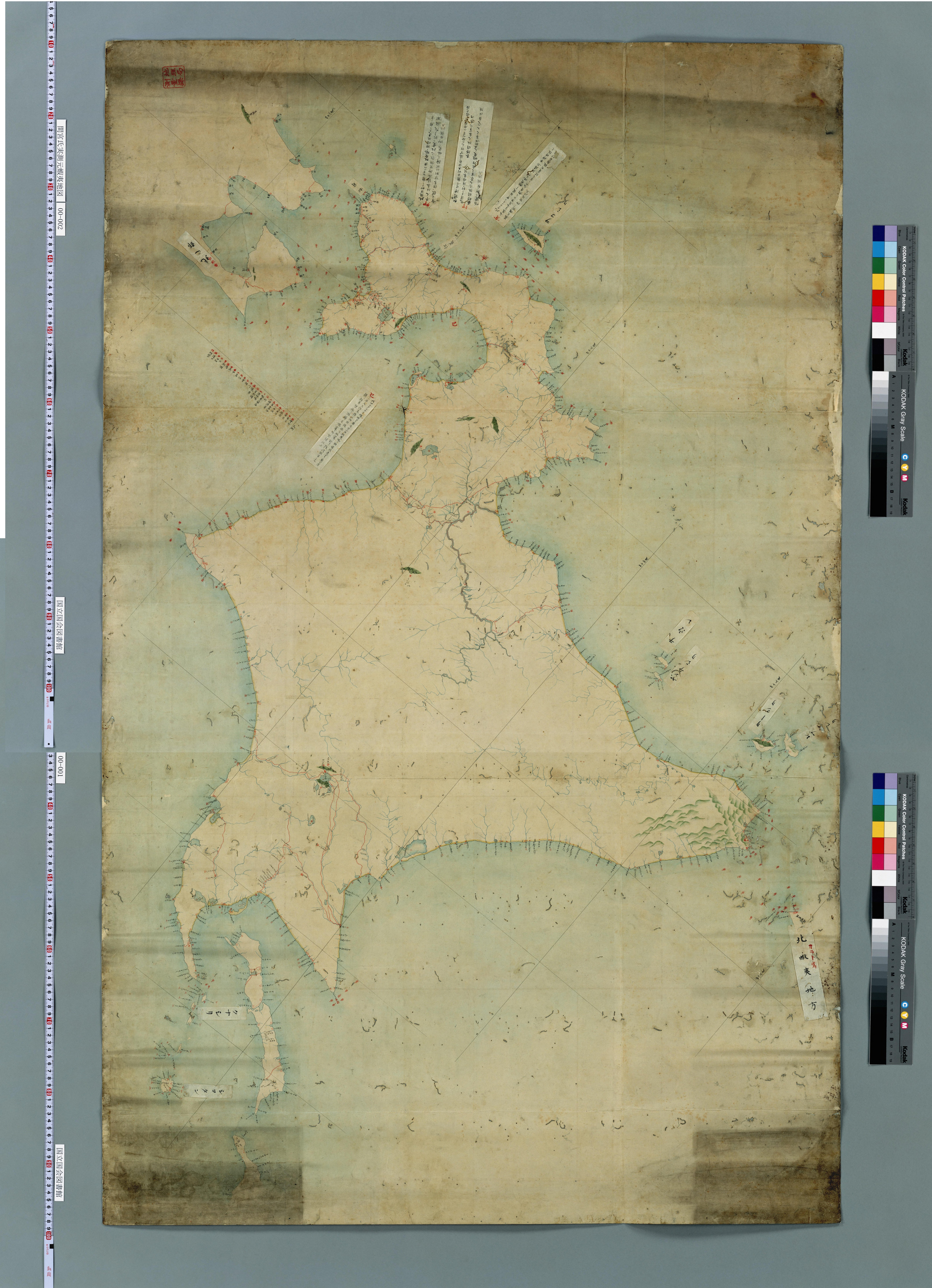
‘Map of Ezo based on the survey of Mr. Mamiya’ (Mamiya shi jissoku moto Ezo chizi 間宮氏実測元蝦夷地図), s.d., Ansei era (1855–1860)?, manuscript, colors, National Diet Library Tokyo, URL: link.

The current Japanese term for ‘map’ (chizu 地図) came into vernacular use with the establishment of the Meiji-period (1868–1912) educational system. It was already in use among cartographers in the late Edo period (1603–1868), as indicated by a note on the backside of the ‘Map of Ezo based on the survey of Mr. Mamiya’, shown to the left, which was likely produced by the bakufu. The literal translation of ‘old map’ into Japanese is therefore ko-chizu 古地図. Between the tenth and mid-nineteenth centuries, however, ‘maps’ were called ‘pictorial chart’ or ‘plan’ (ezu 絵図). 

If you want to reconstruct a history of terms for ‘map’ (chizu), evidence is found in the Kojiruien, a lexical encyclopaedia published between 1896 and 1914. The Kojiruien refers to literary sources: an entry of 1189 (Bunji 5) in the thirteenth-century chronicle of the Azuma kagami mentions ‘maps of both provinces’ (ryō kuni ezu 両国絵図); in contrast, the ‘True account about master [Shibukawa] Shunkai’ (Shunkai sensei jikki 春海先生実記) by the astronomer Shibukawa Hironari (1688–1727) includes an early reference to the now common term chizu, namely ‘maps of our country’ (waga kuni no chizu 我国之地図) (as shown in a manuscript of the Shunkai sensei jikki held by the Waseda University Library). Written records used in legal and administrative spheres (such as land deeds, bills of sale, last wills, account books) confirm the literary sources quoted in the Kojiruien. A query in the databases of ‘old documents’ (komonjo 古文書) from the Nara (710–794) to the Kamakura period (1185–1333), provided by the Historiographical Institute of the University of Tokyo, indicates that chi-zu appears from the eighth century, but not as a compound word, but rather in combination, such as ‘map of newly reclaimed fields and field land’ (konden yachi-zu 墾田野地図), or ‘map of substitute land’ (daichi-zu 代地図). In contrast, the earliest safely dated document that refers to ‘map’ as ezu is from 992 (Shōryaku 3). ‘Pictorial chart’ (ezu) was in use until the early Meiji period and is hence to be considered a synonymous, though antiquated term for chizu. In other words, ezu and ko-chizu can be used interchangeably to designate ‘old maps’.

.

Dai Nihon dōchū kōtei saikenki 大日本道中行程細見記 (right section), [Shinsaibashiminami (Osaka): Kichimonjiya Ichibē 吉文字屋市兵衛, c. 1770s–1830s], woodcut, colour, University of Zurich, Japan Library.

Apart from ‘pictorial chart, plan’ (ezu), the sources know a wide range of designations for maps. Many include the character ‘chart’ (zu 図) only, such as ‘map of fields’ (den-zu 田図), ‘provincial map’ (koku-zu 国図), ‘map of Japan’ (Nihon-koku zu 日本国図) and ‘sailing chart’ (kōkaizu 航海図), or ‘complete map’ (zen-zu 全図) respectively, such as ‘complete map of Great-Japan’ (Dai-Nihon-koku zenzu 大日本国全図) and ‘complete map of the countries of the world’ (kon’yo bankoku zenzu 坤輿万国全図). Likewise, the word ezu is also found in map titles, including ‘map of the castle’ (shiro ezu 城絵図) and ‘provincial map’ (kuni ezu 国絵図). But other terms appear as well. For instance, Edo-period travel maps carry the word ‘pictorial’ (zukan 図鑑) or ‘precise record’ (saiken-ki 細見記) in their titles. This is comparable to old European maps, which include various Latin words in their captions, including tabula, ‘chart’, or forma, ‘list’, descriptio, ‘description’, or imago, ‘picture’.

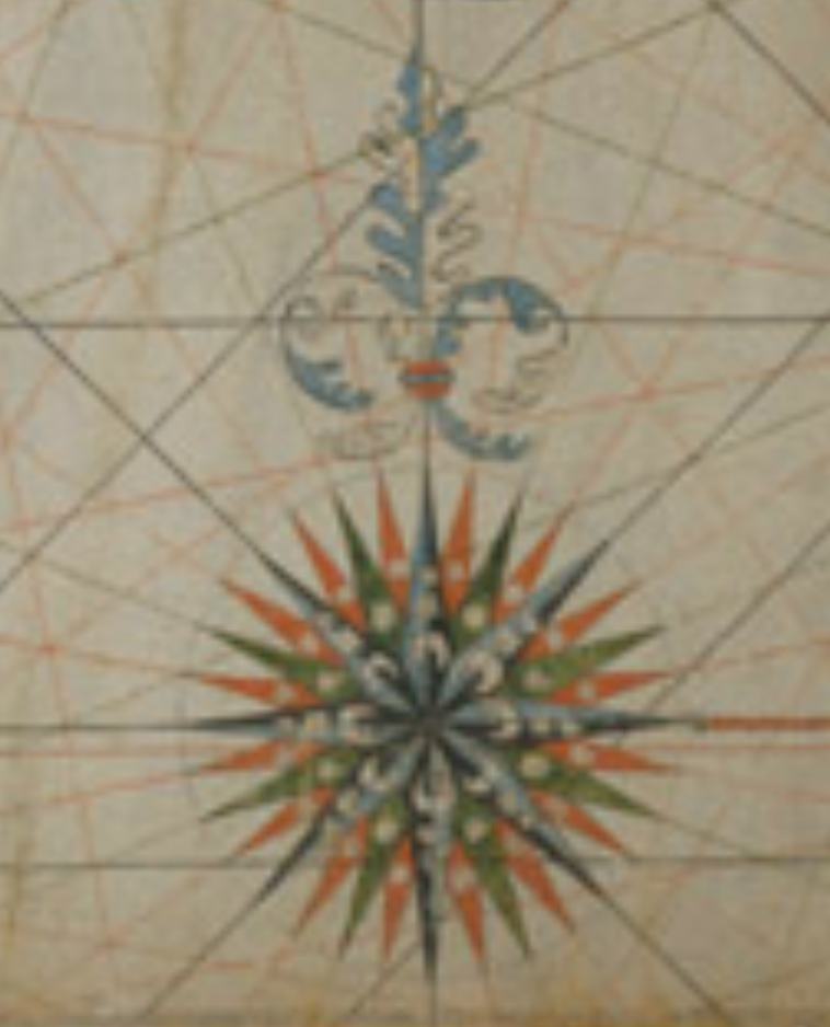
‘Nautical chart of Asia’ (Ajia kōkai-zu アジア航海図) (section), 17th c., 62.2 x 94.3 cm, Tokyo National Museum, URL: https://webarchives.tnm.jp/imgsearch/show/C0072835

If you search for Japanese language references on old maps, you should try the term ‘map’ (chizu 地図), or ‘old map’ (ko-chizu 古地図) or the historical term ‘plan’ (ezu 絵図) respectively. If you are looking for old maps, that is, source material, but you don’t know the precise title, you should modify the search ‘map’ (chizu) by years or region. Note, however, that ancient names for regions differ from present-day designations. For instance, the old Japanese name for India (Indo), which was in use until the early twentieth century, is Tenjiku 天竺. Again, pre-Meiji-period maps of Tokyo are found under ‘maps’ of ‘Edo’, and maps of Hokkaidō under ‘maps’ of ‘Ezo’ (Ezo-chi 蝦夷地) or ‘maps’ of the ‘northern regions’ (hoppō 北方) respectively.

What is more, modern historiographic naming conventions too are subject to change. A seventeenth-century map of Asia, painted with ink and colors on vellum, used to be called a ‘Portolan-style chart for Oriental nations’ (pōtorano-kei Tōa-zu ポートラノ型東亜図) by the cartographers Akioka Takejirō (1895–1975) and Nakamura Hiroshi (1891–1974) in their books, Japanese history of cartography (Nihon chizu shi) of 1955 and East Asia in Maps of 1962 respectively. It is now found unter the designation ‘Nautical chart of Asia’ (Ajia kōkai-zu アジア航海図) at the Tokyo National Museum. In sum, looking for old maps implies engaging with the history of terms for maps themselves as well as for the regions, they are showing.