Introduction

.

Schley, Jacob van der, ‘Plan de Jedo – Platte Grond van Jedo,’ in Prévost d’Exiles, Antoine François, Histoire Generale des Voyages (La Haye: De Hondt, 1747–1768, nouvelle éd. revue sur l’original Anglois), vol. 14: ‘Voyage d’Engelbert Kaempfer au Japon,’ pp. 296–297, copper-etched, 25 x 24.5 cm; ETH Library Zurich, Rar 5738, DOI: https://www.e-rara.ch/zut/content/pageview/3663515

‘Maps […] are always more than mere factual statements. They are translations of reality into forms we can master; they are fictions and acts of imagination communicating more than scientific data. So they reflect changes in our pictures of reality.’

Roberts, John M., The Triumph of the West (London: British Broadcasting Corporation, 1985), p. 194.

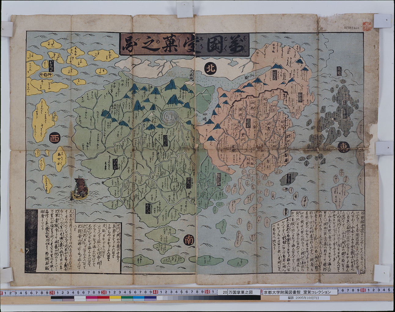
Can you agree with John M. Roberts that maps are ‘fictions’ that ‘reflect changes in our pictures of reality’? Roberts’s idea refers to the first argument of this unit, namely that maps mirror shared belief systems and world views. A mid-eighteenth-century European map illustrates this argument. It shows the spiral plan of Edo (present-day Tokyo) in accordance with Japanese maps. But its Dutch illustrator Jacob van der Schley (1715–1779) has filled Edo castle grounds, forming the center of the map, with a French formal garden. Schley's map suggests that gardens are indispensable elements in the imagination of aristocratic houses in early modern Europe. Maps are sometimes intentional manipulations, by referring to particular place names (Japan Sea, East Sea) or omitting particular data (the distribution of radiation) respectively, which trigger a sense of crisis (geopolitical conflict, environmental change).

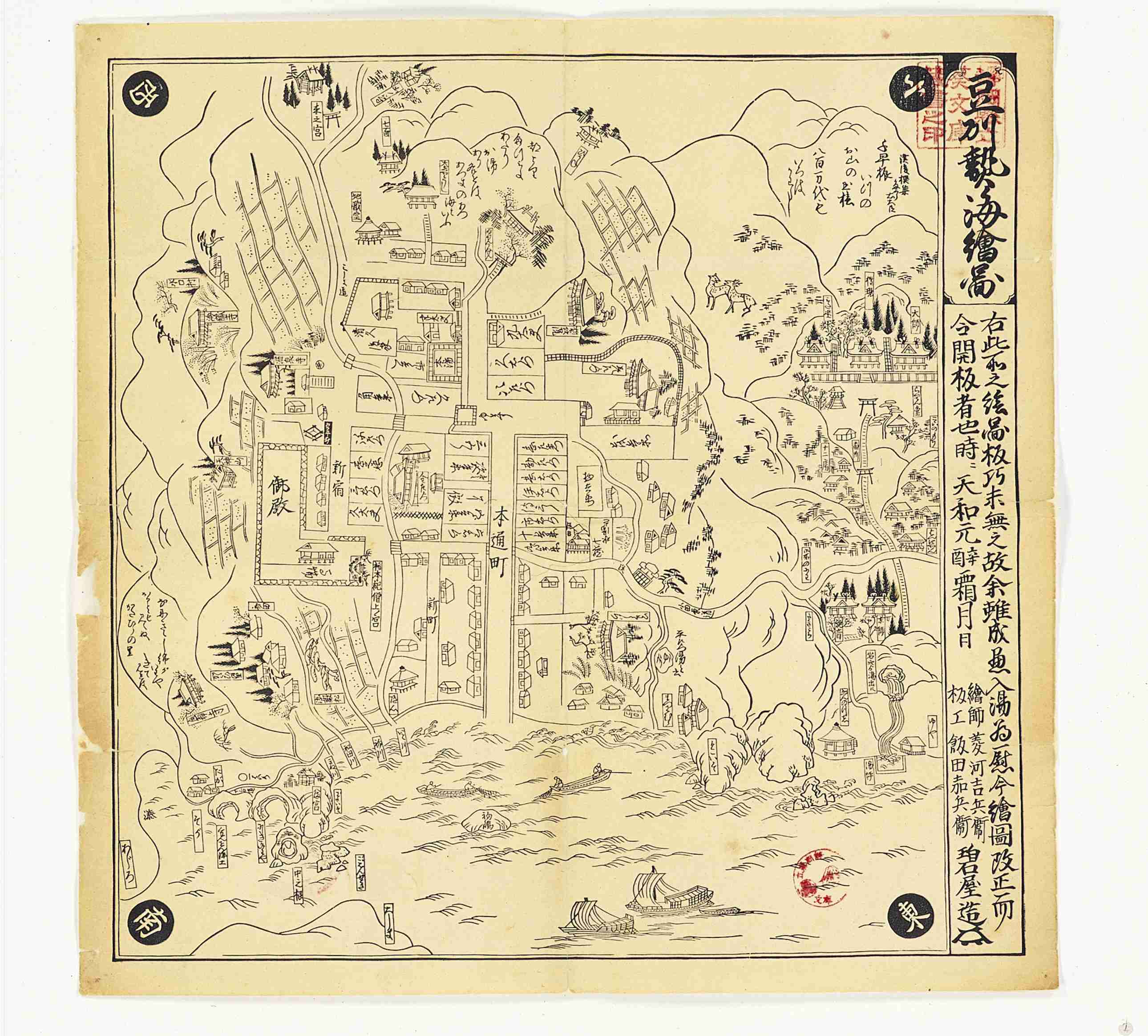
You might object that maps are more often than not quite precise representations of absolute space. In response to this objection, the second argument of this unit is that maps can offer a glimpse into ‘real’ historical conditions. Mid-nineteenth century Japanese maps of Edo, for instance, show that daimyo storehouses were found east of Sumida river in the commoner quarters, whereas merchant shops were located within the area of the western hills, reserved for daimyo residences. The maps suggest that socio-economic divisions were far less pronounced in the practice of everyday life than in the status ideal propagated by the political elite.

‘Map, in which the myriad of countries [are like] a fruit in one’s palm’ (Bankoku shōka no zu 万国掌菓之図), colour woodcut, 53 x 70 cm, Kyoto University Library, URL: https://m.kulib.kyoto-u.ac.jp/webopac/RB00020078

The title is an abbreviation of the Nansenbushū bankoku shōka no zu of 1710 by the monk Hōtan. Jampudvīpa (J., Nansenbushū) is the world according to Buddhist cosmography, whereas a ‘myriad of countries’ (bankoku) refers European-style world maps. The layout as well shows Hōtan’s syncretism. The funnel-shaped imaginary four continents grouped around Mount Sumeru form a contrast to the more accurate depiction of Japan and neighboring regions, including Ezo and Ryūkyū (the island carrying the name Ryūkyū agrees with present-day Taiwan - called ‘Small Ryūkyū’ during the Ming dynasty, whereas ‘Big Ryūkyū’ designated current-day Okinawa). The colored print, shown here, is addressed to a lay audience and thus likely dates from the late eighteenth or early nineteenth century, when commoners had increasing access to books about the world.

This tutorial first considers old maps as historical sources and presents keywords, allowing to search for old Japanese maps. It then provides an overview of old maps that reflect key developments in Japanese history from the seventh to the early nineteenth century. Written records about the imperial court's initiative to map Japan's provinces in the seventh century reflect the birth of the ancient state. Maps of fields and estates show the centrality of land as a basis for political, economic and social life in the ancient and medieval periods. The multiplication of map types from the sixteenth century onwards offers a glimpse into political, social and economic shifts: world maps refer to Japan's foreign exchange; castle, Japan, road and city maps show the degree of unification within early modern Japan, by illustrating travel through politics, trade and leisure, while also indicating regional and social cleavages between domains and status groups. Finally, in place of a conclusion, this tutorial reviews the history of surveying, the precondition for map-making.

The overview is far from complete. Japanese early maps of foreign countries, in particular, are omitted: so-called ‘maps of the five regions of India’ (Go-Tenjiku-zu) and the related ‘maps, in which the myriad of countries of the world [are like] a fruit in one’s palm’ (Nansenbushū bankoku shōka no zu) that show Japan’s idea of the world according to Buddhist cosmography; fifteenth-century East Asian maps, which developed under the influence of Islamic cartography as a consequence of the Eurasian exchange in the wake of the Mongol expansion; and Portuguese-style ‘nautical charts’ (kaizu), so called portolans, which give evidence to Japanese maritime ventures in South East Asia in the sixteenth century. Nor does the tutorial do justice to the multifaceted representation of space in the so-called Edo period (1603–1868): bird’s eye views of famous places, humorous maps, three-dimensional maps, disaster maps, mountain and mine maps, provincial maps, village maps, temple charts and so on. As a supplement in the resources, however, you will find a list of publications that discuss Japan’s historical transcultural exchange and flourishing print culture through old maps in more detail as well as a timeline of Japanese maps.

.

‘Fukuoka City for tourists’ (Kankō no Fukuoka shi 観光の福岡市), subtitle ¨‘Map of Fukuoka City and surroundings’ (Fukuoka-shi oyobi fukin annaizu 福岡市及付近案内図), Fukuoka: Fukuoka-shi Kankō kyōkai, 1934, first ed. 1932), bird's eye view, colour print, author's collection.

Meinohama 姪浜 is situated to the left (West) of Hakata Bay. It was incorporated into Fukuoka City, from which it is sperated by the Muromi River 室見川, just a year before the map's publication, in 1933. Note that the map also includes Korea (Chōsen 朝鮮) at the horizon, annexed in 1910, thus referring to the expanding Empire of Japan.

In recent years, digital humanities have significantly expanded the repertoire of historical geographic information systems (HGISs), that is, the geographical contextualization and visualization of historical data (HGIS Bibliography). Richard White has indicated that HGIS has its limits, because the way people construct space is not necessarily commensurate with absolute space. According to him, however, spatial history is a ‘means of doing research’:

[...] it generates questions that might otherwise go unasked, it reveals historical relations that might otherwise go unnoticed, and it undermines, or substantiates, stories upon which we build our own versions of the past.

Richard White, ‘What is spatial history,’ spatial history lab 1.2.2010

Strictly speaking, this tutorial does not address HGIS. This tutorial is about ‘old maps’, defined as maps made before 1945, and not about historical maps, defined as present-day maps visualizing historical data. Depending on your research question, any historical source can be associated with space and thus provide data for an HGIS project. For instance, historians are reconstructing patterns of social relations during witch trials in late-seventeenth-century Massachusetts on the basis of early modern court records; they are analyzing social inequality in American cities of the 1930s on the basis of area descriptions; and they are exploring the meaning of space for the historical experiences of migration, consumption or imperialism in East Asia through newspaper articles, advertisement posters or military reports. That said, old maps are particularly obvious sources to be integrated into HGIS projects: The Salem Witchcraft GISMapping Inequality; Bodies and Structures

For instance, if you want to estimate the urban development of Fukuoka Prefecture during industrialization, maps are invaluable sources (browse the area of Kyushu on Hinata GIS). One map of 1917, held by Fukuoka Prefectural Library, is a ‘Ground plan of harbour construction in Hakata Bay’ (Hakata-wan chikkō keikaku heimenzu 博多湾築港計画平面図). The map indicates a settlement concentration in Meinohama to the west of Hakata Bay. So does a bird's eye view of Fukuoka city, published in 1934, reproduced to the left. The reason is that the Meinohama coal mine, reproduced in a pre-war postcard with the title, ‘A view of Hakata and Fukuoka: Meinohama coal mine’ (Fuku-Haka no meisho: Mei no hama tankō 福博の名所: 姪ノ浜炭坑), had been opened three years earlier. The center of Fukuoka Prefecture's coal mining industry, however, was Wakamatsu (present-day district of Kitakyushu), as revealed by a further map, with the title ‘Modern-style map on the commerce and industry in Wakamatsu’ (Saishin-shiki Wakamatsu shōkō chizu 最新式若松商工地図). This unit, which guides you through finding, reading, interpreting and editing old maps, thus offers a base for HGIS projects, such as about the linkage between coal mining and demographic shifts in Western Japan.

‘London's iron tube underground railway, deep underground’ (Chitei fukaki Rondon no tekkan chika tetsudō 地底深き倫敦の鐵管地下鐵道), in Chūgai Shōgyō Shinpōsha 中外商業新報社, ed., Zuroku: taishin kara fukkō he no jitsujō 図録 — 大震から復興への実状 (Tokyo: Chūgai Shōgyō Shinpōsha 1925, first edition, 1924), no. 3, plate 137.

How many maps, in the descriptive or geographical sense, might be needed to deal exhaustively with a given space, to code and decode all its meanings and contents? It is doubtful whether a finite number can ever be given to this sort of question […]. It is not only the codes – the map’s legend, the conventional signs of map-making and map-reading – that are liable to change, but also the objects represented, the lens through which they are viewed and the scale used. We are confronted not by one social space but by many indeed, by an unlimited multiplicity or unaccountable set of social spaces.

Lefebvre, Henri, The Production of Space (London: Blackwell, 1991, French orig. La production de l'espace, 1974), pp. 85–86.

Henri Lefebvre (1901–1991) refers to the fragmentation of space, brought about by modernity. A plan of the London subway, published in Japan in the 1920s, or the sketches of Tokyo’s Ginza district of Kon Wajirō’s (1888–1973) ‘modernology’ project refer to the transformation of early-twentieth-century cityscapes on a global scale. According to Lefebvre, in contrast from the sixteenth to the nineteenth centuries, there was ‘a code at once architectural, urbanistic, political, a language common to country people and townspeople, to the authorities and to artists’. It would be naive to follow Lefebvre too closely, and to romanticize the unitary world view of older communities lost.

The philosopher Elmar Holenstein has indicated that there are natural limits to the ontological multiciplity and relativism, conjured by constructionists: first the nature of earth itself, and second the nature of visual perception. Maps follow certain rules of representation, first by giving preference to the depiction of complete units (a continent, a country, a city) rather than partial sections and second by adjusting directions to reading cultures (the area of interest is commonly found in the upper section or center of the map respectively). Still, Lefebvre's emphasis on the shift in the representation of space reminds us that we must have some understanding of past political, economic and social formations to decode old maps: the ‘legends’, ‘signs’ and ‘objects represented’ in them. 

Hishikawa Moronobu 菱河師宣, ‘Map of hot springs in Izu Province’ (Zushū atami ezu 豆州熱海絵図), 1681 (Tenwa 1), woodcut, 46 x 47 cm, Shizuoka Shizuoka Prefectural Central Library, URL: http://multi.tosyokan.pref.shizuoka.jp/digital-library/detail?tilcod=0000000027-SZK0003032

You may have noticed that this is one of three units in Adfontes, which is about non-textual sources. The two other units are about photography and numismatics respectively. The interpretation of maps, like coins, requires the combined reading of texts, images and symbols. For instance, modern maps point to changes in altitude, by indicating the height above sea level with Arabic numerals as well as with different graduations. If you compare different maps, let’s say of the National Atlas of Japan (available as pdf via the Geospatial Authority of Japan, Kokudo chiri’in 国土地理院) or maps of Zurich (online via the State Office for Spatial Development of the Canton of Zurich), you are likely to recognize that the shaded squares represent settlement areas, the lines roads or rivers, and the blue spots lakes, because if you were to draw a bird's eye view of a terrain, you would use similar pictorial signs. Nevertheless, you are unlikely to recognize all layers of represented similar or correlated geoferenced data, that is, data that can be related to a ground system of geographic coordinates. To recognize, for instance, the distribution of thermal springs or sports grounds, you should refer to the legend or title of the map.

If you analyze old maps, you must look for information within as well as outside them. For instance, if you have some knowledge of Japanese cursive characters (kuzushiji), you will recognize the title, date and artist's name in the ‘Map of hot springs in Izu province’ (Zushu atami ezu 豆州熱海絵図). But you will have to consult further references to identify the artist Hishikawa Yokishibee 菱川吉兵衛 with Hishikawa Moronobu 菱川師宣 (1618–1694). And you will have to compare the map with further seventeenth-century views of famous places, showing hills, trees, deers, dwellings, or ships, to get a sense of the representation of space in early modern Japan. The interpretation of old maps, which often integrate scripts, images and symbols, which you are unacquainted with, is thus challenging as well as rewarding, by enhancing your analytical skills in history, art history, philology and geography.

.

‘The Emperor’s Court at Jedo,’ in Arnoldus Montanus, Atlas Japannensis (London, Printed by Tho. Johnson for the Author, and are to be had at his House in White Fryers, M.DC.LXX [1670]), Collection of International Research Center for Japanese Studies (Nichibunken), pp. 146–147; URL: http://shinku.nichibun.ac.jp/kichosho/new/books/01/pageview1/zoomify/000135541_0044.html

Interpreting old maps, like other historical sources, implies asking questions: Who is the author, the addressee and the initiator? What is the date of production? What is the used material? Is the map a unique copy, or was it circulated in multiple runs? What does it show? What is the artistic and what the scientific quality? Was the map meant as an addendum to written records, or does it contain self-explanatory instructions to its use? Does it resemble other map types? Is the map linked to written or visual genres? We have seen that in his eighteenth-century ‘plan de Jedo’, Schley represents Edo castle grounds with a French formal garden. In the Atlas Japannensis of 1670, Arnoldus Montanus (c. 1625–1683) includes a view of Edo castle. The garden before the castle is in geometric patterns. Schley’s map was hence not produced in a vacuum, but relied on earlier images.

Finally, what is the intention of production? Has a map been made for posterity, the intention being to convey a symbolic meaning; or, has it been handed down to us by chance, which refers to its pragmatic use? This last point is related to the divide between ‘traditions’ and ‘relics’, forwarded in the classical source typology of historians, such as Johann Gustav Droysen (1808–1884) and Ernst Bernheim (1850–1942). Like in the case of other sources, however, this divide is fluid and depends on the asked research questions. If you analyse a fourteenth-century Japanese estate map, produced during a boundary dispute, as evidence to the representation of authority, you may interpret it as ‘tradition’, that is, an intentional testimony addressed to later generations. But if you use the same map to locate particular place names or reconstruct painting techniques, then it has the character of a ‘relic’, an unintentional evidence of the past. Through original and precise research questions, maps, like other historical sources, not only confirm but also allow to challenge established historical assumptions.