Typologies of old Japanese maps
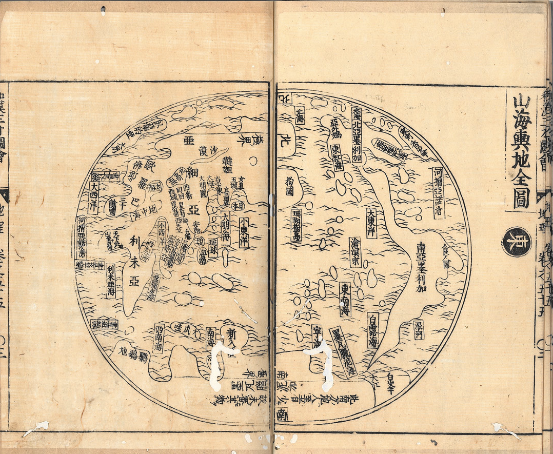
“Complete map of mountains, seas, and earth” (J., sankai yochi zenzu, C., shanhai yudi quantu), in Terajima Ryōan 寺島良安, Wakan sansai zue 和漢三才図会 (Edo: Okada Saburō Saemon, Torikai Ichibee, Shibukawa Seiemon, Matsumura Kyūbee, 1713, first pub. 1712), earth part (chibu), chapter 55, held by Kyushu University Library, Manuscript Library, Historical Records, Minagi Kuroda Family Collection.
Typologies of old Japanese maps are not unified, because they reflect a combination of different criteria, namely the subject choice, such as maps, showing Japan (e.g. ancient Gyōki-zu, Edo-period Ryūsen-zu), the context of production or use (e.g. medieval estate maps, Edo-period travel maps) and technical improvement (e.g. pictorial charts, so-called ezu, or sketches, so-called sashizu).
According to their discipline, scientists might emphasize different criteria. Geographers might be concerned with drawing techniques or precision as typological criteria, historians with the context of production or use, and art historians with the subject matter or artistic technique. Nevertheless, library catalogues reflect a consensus concerning several map types: Edo-period maps used for travelling, fall under the type of travel maps and not Japan maps, though often they show the entirety of Japan; maps of Japan's coast lines produced by Inō Tadanaka in the early nineteenth century are listed as a separate category, because they are viewed as the take-off of modern cartography in Japan, rather than being summarised under regional maps or Japan maps. Likewise, maps of Ezo (present-day Hokkaido), the Kuril Islands and Sakhalin are usually treated as a separate type, namely ‘maps of the northern territories’ (hoppō-zu).
You will find a suggested typology of old Japanese maps, together with a timeline, on the next page.